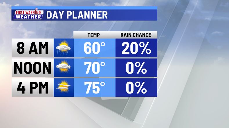
Morning rain clears to sunshine, mild temps

AUSTIN (KXAN) — Damp weather to start the day but sunshine will be quick to return by early afternoon.
Any lingering rain and cloud cover is expected to clear by late morning allowing for a mainly sunny and dry Tuesday afternoon. Temperatures will run a touch cooler than what we felt Monday but will still be comfortable with most of us topping out in the low to mid-70s.
Tomorrow will feature a mix of sun and clouds with afternoon highs in the upper 70s. By Thursday, our weather begins to transition to an approaching Pacific storm, expected to bring significant impacts to our weather Friday into Saturday.

This Pacific storm will drag a cold front through Central Texas Friday night into early Saturday bringing the best chance of meaningful rain and strong thunderstorms. Preliminary outlooks are suggesting the chance of severe weather locally on Saturday. Stay with KXAN as we get more details on rain timing and severe weather risk over the coming days.
FIRST WARNING WEATHER: Stay up to date with your Central Texas forecast, sign up for our weather newsletter at kxan.com/newsletters
Summer Heat
Meteorological summer ended on Aug. 31, as Camp Mabry recorded its second-hottest summer in recorded history. Austin-Bergstrom recorded its 7th-hottest summer on record.
Sign up for our daily forecast newsletter at kxan.com/newsletters. Download the KXAN Weather app to get the latest weather forecast: Apple | Android
___________________________________________________________________________________________
Follow the KXAN First Warning Weather team on Facebook, Twitter and Instagram.
You can also follow our meteorologists’ individual accounts for livestreams and a little bit of what goes on behind the scenes:


